Little League Memories

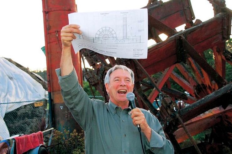
By Jerry Taylor and Larry Clinton, Sausalito Historical Society

Long before he was president of the Historical Society, Jerry Taylor was president of the Sausalito/Marin City Little League. And long before that he was a shortstop for the Sausalito Police Department Stars, one of this town’s earliest Little League teams.

In 1996 the league held a special celebration to recognize the official naming of the field in honor of the man who coached local kids through five decades, Konnie Knudsen. On that occasion, Jerry detailed the history of the league for this newspaper.  Here are some excerpts from his account:

Sausalito's Little League Baseball traces its history to 1953, when Joe Morello, a former pro baseball player, organized a team of youngsters who played a series of games with a team from Tiburon.

PHOTOS FROM SAUSALITO HISTORICAL SOCIETYThe Little League diamond in 1957

PHOTOS FROM SAUSALITO HISTORICAL SOCIETY

The Little League diamond in 1957

In 1954, the Sausalito Fire Department was enlisted as an official sponsor. Chief Matts Perry directed fireman Swede Pedersen to assist coach Joe Morello. A league was formed with Mill Valley and Tiburon; Sausalito's representatives won the name "Giants" in a drawing. (When the NY Giants moved West in 1958, Sausalito sent a delegation to Seals Stadium to officially welcome and adopt them.) With no home field of its own, the Sausalito team was unofficially the "orphans". The team finished one game behind the Mill Valley Yanks, at 6 wins and 6 losses. The Sausalito News carried weekly stories about the financial and organizational progress, and game descriptions.

In 1955, a field was created on Herb Madden's land, then called Shell Beach (between where the Bank of America and the Spinnaker stand today). Mill Valley had created its own league, so Police Chief Louis Montanos helped create the Police Department Stars, who joined the Giants and played against teams from Tiburon and Strawberry.

By 1956, interest had grown to enable Sausalito to stand on its own, and the Rotary Club Oaks and Salvage Shop Seals debuted. (The new teams took their names from the Bay Area’s highest-level professional teams, the San Francisco Seals and Oakland Oaks of the Pacific Coast League.) The games moved to Richardson Bay School. The managers were: Ed Souza Giants; Fred Gustafson Stars; Wally Mays Oaks; and Konnie Knudsen Seals. Enough boys turned out to fill four teams and to create a Farm Team under Bud Bettencourt. The First all-Sausalito league resulted in a championship for the Seals, presented to the head of the Sausalito Salvage Shop, Clara Crosby, “the Mother of Sausalito Little League."

In 1957, the league received permission to create a permanent home at what is now Willow Creek Academy. An account written the next year recounted how: “Much work and planning was done to develop the diamond from a dusty, rugged field to a regulation ball diamond. With the guidance of Pres. Willard ‘Red’ Hall, parents and youngsters and many friends of Little League were called on to turf the diamond, build dugouts, etc.”

Over the ensuing years, the ball players and their parents grew older and moved on to other interests, but one of us stayed active in Little League for forty years, and embodied Little League baseball to generations of local kids. That's why we recognize his lifetime of dedication and are naming the ballpark

For Konnie Knudsen for his years of dedication to the Little League.

In March, 1996, grizzled league veterans Chuck Bradley and Jerry Taylor organized an alumni reunion softball game for players from the earlies days. The boys of the 1950's were in town to honor Knudsen and all the founders of the league at the ceremonies, and to meet again on the ball field of their youth. Here’s how Jerry described the day in the March 19, 1996 Marinscope:

We rode proudly on a truck together in the parade, cheering our 5-15 year old successors ahead of us, proud of our roles, and our parents' roles, in their heritage. We cheered, and we cried at the field during the ceremony. We watched the kids wearing "our" uniforms reenact time-honored customs, and we were young again.

The Sunday morning gathering at Smitty's was full of stories. I saw guys I knew from Cub Scouts and Central School for the first time in thirty or thirty-five years. Following some light lubrication, we reassembled our old teams on the field. The original team, the Giants, from 1954, and the Stars, founded in 1955, linked together under the coaching of Bob Souza, whose father Ed coached the Fire Department Giants to a championship in 1957. The "newcomers" Oaks and Seals, who started in 1956, were coached by Dick Bettencourt, whose dad Bud had coached many of us boys in the 1950's.

The game ended in a familiar manner, as someone muttered: "Damn Seals, they won again." But that's not quite right. We all won, and we're ready to suit up again.

This year, Konnie Knudsen’s son Steve and his daughter Honour are coaching a team that they named the Seals in honor of their father. Opening day is scheduled for Saturday, March 14, starting with a parade of players, coaches and parents in decorated vehicles. At Konnie Knudsen Field, there will be well-wishes and recognition of volunteers and their contributions to the league, refreshments and photo ops. Topping it off will be a home run derby.  For details, check the League’s website: https://www.smcll.com.

PHOTOS FROM SAUSALITO HISTORICAL SOCIETYThe Little League diamond in 2020

PHOTOS FROM SAUSALITO HISTORICAL SOCIETY

The Little League diamond in 2020

Lime Point from Prominence to Obscurity

By Robert L. Harrison and Larry Clinton, Sausalito Historical Society

This report is a lightly edited excerpt from an essay by Bob Harrison for the Anne T. Kent California Room:

Many in Marin are not aware of the name Lime Point, a significant feature of the Marin headlands made less conspicuous today by the presence of the Golden Gate Bridge. The Point is that bit of land framing the north side of the passage through the Golden Gate. Together with its counterpart to the south, Fort Point in San Francisco, it forms the doorway to one of the world’s great harbors. Lime Point was for many years intended to be a key player in the protection of San Francisco Bay. But in recent years that once prominent point of land has become almost invisible.

We have previously described how Golden Gate was named by John C. Fremont in 1848. How Lime Point emerged as a name is less clear.  Jose de Canizares in 1776 drew the first map to identify the point.  Canizares was the sailing master under Captain Juan Manuel de Ayala of the Spanish ship San Carlos, the first European vessel to enter San Francisco Bay.   On his Plan del Gran Puerto de San Francisco Canizares named the northerly edge of the entry to the Bay as the Punta de San Carlos.  Lime Point was named Punta de Santiago on later Spanish maps.  The Spanish maps made no reference to limes or limestone.

PHOTO © ROBERT L. HARRISONLime Point Fog Signal Building in background; the Needles rock formation in left foreground

PHOTO © ROBERT L. HARRISON

Lime Point Fog Signal Building in background; the Needles rock formation in left foreground

The first mention of lime appears on a map based on the surveys of San Francisco Bay by Capt. F. W. Beechey of the Royal Navy. In his 1831 Narrative of a Voyage to the Pacific Beechey described the entrance to the Bay, “The port of San Francisco does not show itself to advantage until after the fort [Point] is passed, when it breaks upon the view, and forcibly impresses the spectator with magnificence of the harbor.”  

The map entitled The Entrance of San Francisco Harbor, based on Beechey’s 1828 survey, identifies the point of land forming the north edge of the Bay’s entrance as Lime Rocks. The English surveyors of the Bay, it seems, believed the rocks that formed this point were of the same white chalk limestone that forms the cliffs of their island nation. Lime Point in fact, often covered in white bird droppings, is dark in color and mostly composed of pillow basalt.  Over time Lime Rocks on Beechey’s map became Lime Rock Point. In future references to this most significant segment of the Marin headlands it became simply Lime Point.

President Millard Fillmore established the Lime Point Military Reservation in 1850. In 1853 Congress gave further recognition to the importance of Lime Point by designating it as one of the three locations to be fortified for the defense of San Francisco Bay. A congressional action provided $500,000 to fortify Alcatraz Island, Fort Point and Lime Point.  

The government did not own the land at Lime Point in 1853.  The debate and court challenges over the purchase of Lime Point dragged on for over ten years and became known by some as the Lime Point swindle.  From the Sacramento Daily Union of August 1, 1866: “Lime Point has been at last purchased by the United States.  It is rumored that the price paid is $165,000.”

Finally, in 1867 work began on the long promised fortifications for Lime Point. The largest blasting operation in the country was used to create a level site for the proposed multi-tiered casemate fort.  However, the work was stopped almost before it began due the expiration of funds. By 1876 a series of smaller batteries located near Lime Point were completed at Gravelly Beach (today’s Kirby Cove), Point Cavallo and on the bluff above the Point.

Heavy fogs that blinded ships attempting to enter the Bay made clear the need for a fog signal at the Point. Of particular note was the wreck of the steamship Costa Rica in September 1873. Headlines in the Daily Alta California read: “The ‘Costa Rica’ Ashore. A Magnificent Steamer Wrecked for the Lack of a Few Barrels of Water. The Vessel Runs on Lime Point While Seeking for the Fog Whistle.”  Unfortunately, the steam powered fog siren, recently installed at Point Bonita, was inoperative because no fresh water was available to make steam. It seems the system was dependent on rainfall and by September of 1873 its cisterns were empty. The Costa Rica was heavily damaged but fortunately the incident caused no loss of life and most of the cargo was eventually salvaged.

In September 1883 twin twelve-inch steam fog whistles, powered by coal fired burners, were placed in operation at Lime Point.  A reliable fresh water supply was constructed from springs near the top of the bluff, some 1,800 feet from the fog station.  In 1902 the system was converted from the coal to more efficient and less polluting oil.  

Lime Point Station was automated in 1961 and all structures except the decaying fog signal building were removed. Since the completion of the Golden Gate Bridge in 1937, the location just east of the base of the Bridge’s north tower goes mostly unnoticed.  It has been largely obscured by the great structure above.

Whither Travis Marina?

By Larry Clinton, Sausalito Historical Society

“One of Marin’s best-kept-secret views of the Golden Gate Bridge is through the windows of an unassuming-looking building that sits behind the Discovery Museum on the shore of Horseshoe Cove at Fort Baker.” That’s how Marin Magazine described Travis Marina, home to the Presidio Yacht Club at Fort Baker.

PHOTO FROM NATIONAL PARK SERVICE Travis Marina and Horseshoe Cove

PHOTO FROM NATIONAL PARK SERVICE Travis Marina and Horseshoe Cove

The Marina has a long history, but a cloudy future. Fort Baker was established in 1897 as a satellite station of the Presidio of San Francisco. The fort became part of the Army’s Coast Artillery Crops in 1907.

Around 1900 a golf course was added to the parade ground. In his book Moments in Time, Jack Tracy writes: “Sausalito golfers designed the course and constructed all the traps and greens. It was so popular that the Sausalito Golf Club was organized and a clubhouse built near the edge of the parade ground.” The military reservation was already a favorite of local hikers and picnickers. Dances and parties at the post were well attended by Sausalitans.  So, the tradition of civilian recreation at Fort Baker dates back well over a century.

Militarily, the fort served primarily as a training facility until the onset of WWII when a working boatyard sprung up to maintain the “Army’s Navy” – the fleet of small boats that maintained the Coast Artillery’s undersea minefields anchored just outside the Golden Gate Straits.

By the early 1960s the army’s need for a full-service boat repair operation had dwindled, and the former mine boat shops and marine railways were transferred to the jurisdiction of the Presidio Yacht Club (PYC), a “quality of life” recreational facility open to active duty military personnel and retirees. The former lumber loft was converted into a wood paneled lounge complete with a bar, dance floor, and tables. Existing windows in the south wall on both floors were enlarged to provide stunning views of the Golden Gate.

In 1972 East Fort Baker was included in the new Golden Gate National Recreation Area (GGNRA),

But the PYC and its members continued to operate as a semi-private yacht club within the boundaries of a National Park.

By the mid-1990s, the Sixth Army at the Presidio was inactivated. The Presidio Yacht Club would have to find another military post as a sponsoring agency if it was to retain its military status. In late 1994 Col. David Peixotto, President of the PYC Advisory Council, wrote the U.S. Army asking if it was possible for Travis Air Force Base to take them over after Base Closure. Final approval for a 5-year agreement was granted in April 1995.

At the termination of the original 5-year agreement, oversight of the Yacht Club was turned over the National Park Service, which has continued to grant a permit to the Travis Sailing Center and Marina on a year-to-year basis. The small bar and grill are open to the public, and occasionally feature live music.

Now, the NPS is looking at developing plans for the Fort Baker waterfront that may include transforming the yacht club from a semiprivate Marina to a day-use facility similar to Ayala Cove at Angel Island State Park. You can read more about the NPS’ plans at https://www.nps.gov/goga/learn/news/foba-rfq.htm.

A group of concerned locals, who want to keep the marina and yacht club accessible to its loyal community, and to preserve it for military families, has started a campaign to save Travis Marina in its current form as an alternative to the upscale Farley Bar and Murray Circle restaurant at the nearby Cavallo Point Lodge. A community-led petition to keep yacht club and waterfront with Travis Airforce Base has garnered more than 8,450 total signatures. Information on this effort is available at https://www.change.org/p/save-historic-travis-marina-before-it-s-too-late/sponsors/new.


PHOTO FROM NATIONAL PARK SERVICE

Travis Marina and Horseshoe Cove

The Great Marin Race for a “Good Road to the Ferry”

By Robert L. Harrison and Larry Clinton, Sausalito Historical Society

The following is a lightly edited excerpt from an essay by Bob Harrison for the Anne T. Kent California Room:

In the early 20th century, long before there was a Golden Gate Bridge, the ferry connection between Marin County and San Francisco was a dominant factor in Marin’s development. Tiburon and Sausalito competed to become the principal site for this connection.  Both towns were 6.5 miles across the Bay from San Francisco, and both were railroad terminals serving Marin and locations to the north.   

 Marin’s two railroads provided extensive wharves and marine support services as well as direct ferry service to San Francisco. In 1907 these lines were merged to form the Northwestern Pacific (NWP) Railroad.    

PHOTO FROM SAUSALITO HISTORICAL SOCIETY Sausalito’s railroad terminal and ferry wharves in the early 1900s

PHOTO FROM SAUSALITO HISTORICAL SOCIETY
Sausalito’s railroad terminal and ferry wharves in the early 1900s

Sausalito had an advantage because in 1909 the NWP completed the connection from the Sausalito line at Baltimore Park to detour on the mainline from Tiburon to San Rafael.  With this “cut-off,” the railroad assigned virtually all passenger service, electric and steam trains, to the Sausalito ferry terminal.  Tiburon remained the railroad’s freight and maintenance depot but lost most of its direct ferry service to San Francisco. A ferry shuttle was provided from Tiburon to Sausalito with a stop at Belvedere along the way. Yet, despite these changes, Sausalito experienced capacity problems at its terminal which left Tiburon in a position to continue its quest for direct ferry service to San Francisco. 

As the automobile developed, successful ferry terminals needed excellent highway connections as well as a first-rate marine infrastructure. In 1909 Sausalito was included in the first State highway system, State Route (SR) 1 running from San Francisco north to Crescent City. By 1919 Tiburon, with its potential ferry connection to San Francisco, was also included. The State added SR 52, the shortest route in its system, just 5 miles in length, to connect SR 1 at Alto to the ferry terminal at Tiburon.

While both ferry terminals were nominally served by State highways, these roads were generally unpaved, narrow, curvy and poorly maintained. Marin jurisdictions passed several funding measures to improve streets and highways over the years.

State Route 1 was the primary north-south highway through Marin. Until 1930 SR 1 followed various local streets in Sausalito and country roads roughly along the west shore of Richardson Bay to today’s Camino Alto, Corte Madera Avenue, Magnolia Avenue, College Avenue, and Sir Frances Drake Boulevard to San Anselmo. At the Hub in San Anselmo a driver could choose to drive on either SR 1 east to San Rafael or on the county road west to Fairfax.  

In 1930 SR 1 was realigned to follow today’s Hwy 101 alignment from Alto to San Rafael and paved to a width of 20 feet. The route became known as the Redwood Highway. SR 52 from Alto to the Tiburon ferry was completed with the construction of a 20-foot wide bituminous macadam surface roadway from Belvedere crossing to Tiburon on the current Tiburon Boulevard alignment.

And so, Tiburon won the race with Sausalito to have an improved all-paved State highway from its ferry terminal north to San Rafael. (SR 52 to SR 1 at Alto).  As reported in the California Highways and Public Works magazine, with an automobile ferry at Tiburon, “This route [SR 52] will carry a considerable portion of the traffic using the Redwood Highway and will do much to alleviate the present congestion at the Sausalito [ferry] terminal.”

But, ironically, no San Francisco ferry service at Tiburon was provided.  The Southern Pacific Golden Gate Ferries, Ltd., (GGF), reneged on its pledge to establish an automobile ferry within 60 days after completion of the highway. Many years later, in 1962, the Harbor Tug and Barge Company began a passenger ferry service at Tiburon. The railroad never did reestablish regular ferry service to San Francisco at Tiburon.

Meanwhile, into the 1930s the construction of SR 1 to the Sausalito ferry terminal continued. In 1933, SR 1 replaced a convoluted tortuous local street system from Manzanita/Waldo Point to Napa Street with a minimal curvature State highway (today’s Bridgeway).  Prior to the improvement, the State Highway District Engineer called this local street “perhaps the most thoroughly disliked short section [1.3 miles], in so far as the traveling public is concerned, of heavily traveled highway to be found anywhere in the State.”

The State highway to the Sausalito ferry was finally finished in 1934. The portion of the route within the town limits was transferred from the State to the town. Over in Tiburon the State highway remains the primary street in town. Today’s Tiburon Boulevard —renumbered SR 131 in 1964-—still connects the Redwood Highway (U. S. Route 101) with the Tiburon ferry terminal.

It is interesting to note that with all the effort to complete the roads to the ferry terminals, just three years later, in 1937, the Golden Gate Bridge would open to car traffic, and ferry service would experience a rapid decline. All regularly scheduled ferry service from San Francisco to the North Bay would be terminated by 1941.

The Long, Strange Trip of the Charles Van Damme

By Larry Clinton, Sausalito Historical Society

PHOTO COURTESY OF JUDYTH GREENBURGHMichael Rex displays preliminary plans for exhibiting the paddle wheel of the Charles Van Damme | photo courtesy of Judyth Greenburgh | post by Larry Clinton

PHOTO COURTESY OF JUDYTH GREENBURGH

Michael Rex displays preliminary plans for exhibiting the paddle wheel of the Charles Van Damme | photo courtesy of Judyth Greenburgh | post by Larry Clinton

Back in 1983, shortly after moving to Kappas Marina, I was walking to the local laundromat when I spotted a flurry of activity along the waterfront. People were being evicted from the beached ferryboat Charles Van Damme, and bulldozers were waiting to dismantle the decrepit hulk. I didn’t know much about the old ferry, but I knew the community was losing an historic relic.

It turns out the Van Damme has led nine lives, according to the website

https://www. charlesvandammeferry.org/history.html.

1.  Life as a Car Ferry In 1914, prominent San Francisco businessman Charles Van Damme was convinced to invest in a high-tech startup of the day: a car ferry line between Point Richmond and Marin. The Richmond-San Rafael Ferry & Transportation Company was created, and its first progeny was a wooden side-wheeler called The Charles Van Damme (CVD).

In 1943, the CVD was sold to Martinez, and ran between that city and Benicia until 1956, when it was withdrawn from service.

2. Life as A Restaurant The following year Sausalito salvagers brought the CVD to Richardson’s Bay.  In 1958 it was leased out as a restaurant called the Canton Ferry and docked at Jack London Square. Unfortunately, the Canton Ferry went bankrupt the following year and Sausalitan Donlon Arques bought it at auction, then towed it into what became its final resting place at Gate Six.

In 1960 outspoken restauranteur Juanita Musson took over the ferry and turned it into the legendary Juanita’s Galley.  But her emphasis on generosity over business sense, plus an unruly gang fight, finally put her out of business in 1963.

3. Life in The Spotlight A nightclub called The Ark opened on the CVD in 1966 and hosted many well-known musicians, some after finishing their gigs at other nearby clubs and playing until 6 a.m. Moby Grape  used the Ark as a practice venue during the latter part of 1966 and made their live debut there.

4. Life as A Library?  A plan was put forward that year for the town of Sausalito to purchase the Charles Van Damme and turn the ferry into a library…it was eventually turned down.

5. Life as A Hang-Out In the 1970’s Don Arques allowed Joe Tate, leader of the waterfront pirate band known as the Redlegs, to use the CVD for a fund-raiser. The enticement was Free Beer. That first dance led to another, then more. In 1973 a scene from Saul Rouda’s movie Last Free Ride, reenacting the houseboat wars, was filmed on board.

Visitors came and went frequently, including a raft of celebrities from Janis Joplin to Noel Coward. Two visitors who were entertained on the Van Damme for a short time were Rip Torn and Geraldine Page, according to T.J. Nelsen’s book Houseboats, Drugs, Government and the 4th Estate.

6. Life in Danger By then, the activities on the CVD eventually came to the attention of the authorities. Almost immediately public use of the ferryboat was banned. In 1976 the County ordered the CVD abated. Dreams of restoring the ferry proved too expensive, and it was demolished — as I watched — in March 1983.

7. Life in Ruins The smokestack, a name board, and one paddle wheel with shaft still attached, were all that could be salvaged.

8. Life in Limbo On April 24 2005, Catherine Lyons-Labate, a resident of the Gates Co-op, arranged a photo shoot of the community in front of the paddle wheel. That inspired Judyth Greenburgh, Dona Schweiger and Calli-Rose Lyons to celebrate the story of the CVD. They gathered the history, materials, stories, and art inspired by the Charles Van Damme.

9. Life as An Icon Beginning in 2003, the paddle wheel and artifacts were removed by community volunteers, and proposals were submitted to restore them and bring them back to Gate 6. A reconfiguration of Waldo Point Harbor had created a new waterfront park right where the old ferry had been beached, and permission was given to exhibit the ferry artifacts there, once they had been restored. By 2019 all plans, permits and quotes were issued and in place, and a fundraising campaign was underway.

Learn about the ship’s many lives on Friday February 2I at the Sausalito Library. Judyth Greenburgh and well-known local architect Michael Rex will tell the Charles Van Damme Ferry story from past to future. The multimedia show will be presented from 7-8.30 p.m.


When Sally Wed Bob

By Larry Clinton, Sausalito Historical Society

PHOTO FROM SFLUXE.COMSally and Bob in happier times

PHOTO FROM SFLUXE.COM

Sally and Bob in happier times

The other day I wandered into Karl the Store at 1201 Bridgeway, a treasure trove of Sausalito memorabilia, among other nostalgic booty.  Proprietor Dennis Green showed me a May 1951 copy of Life Magazine with a story entitled “Miss Stanford weds Mr. Gump: Sudden ceremony in Reno unites two well-known San Franciscans.”  Here’s the scoop:

Two of the most noted names in northern California were joined together in matrimony last week. In a surprise ceremony at Reno, Nev. Robert Livingston Gump, millionaire dealer in Oriental objects d’art, married Sally Stanford, who has a police record as the keeper of a San Francisco disorderly house. In fact she admits having run the most exclusive establishment of its kind in the U.S.

Each is 47 and has been married twice before. Mr. Gump explained that he and his late father both had known Miss Stanford for some 20 years, but that it was only within the last three years or so, a time corresponding to Miss Stanford’s retirement from the management side of her business (the only side she ever was in), that he had actively sought her hand.

She has recently engaged in a completely virtuous bar-and-restaurant business in Sausalito, across the bay from San Francisco, and it was to this that the couple returned for their bridal breakfast after a brief ceremony.

Meanwhile the Gump firm published an announcement reminding that Mr. Robert Gump was no longer connected with the store. He has recently been employed as a radio news commentator and successfully predicted the outbreak of the Korean war the day before it began (although unfortunately his tape-recorded prediction was never broadcast.)

Mrs. Gump is best known as the former operator of 1144 Pine Street, a handsome establishment furnished with many rare antiques including a Roman bath 9 feet in diameter. The ill-famed house on Pine Street, which had been designed by Stanford White to imitate a Pompeian court, had few windows.

Here over the years “Miss Stanford” (real name — Mabel Busby) and her specially selected young hostesses entertained princes and shahs, movie stars, state and national dignitaries; some of her customers even brought their wives. Perhaps her widest fame came when she played hostess to men of many lands attending the San Francisco U.N. Charter conference in 1945.

Although Mrs. Gump, who retired from her career with a reported million-dollar fortune, has a very comfortable home at present, both she and her husband, yearning for the old house on Pine Street, plan to move back soon.

I’ve read a lot about Sally but didn’t remember this historic union of icons from either side of the Bay — perhaps because it was sadly short-lived.  An obituary of Sally, on the website thetigerisdead.com, states that after eloping to Reno, the lovebirds divorced nine months later.

Sausalitans knew Sally by the name Marcia Owens, but evidently that was one of many pseudonyms for Mabel Busby. According to her autobiography Lady of the House, she saw a newspaper headline about Stanford University winning a football game and adopted Stanford as her surname.


Raising a Stink in Sausalito

By Jack Tracy and Larry Clinton, Sausalito Historical Society

“The most controversial event of 1937 started innocently enough in July when the Gardenia Packing Company asked the Sausalito City Council for permission to moor the ship Brookdale in Richardson's Bay.” That’s Jack Tracy’s take, from his local history book Moments in Time.  Here’s the rest of Tracy’s tale:

The Brookdale was a floating fish reduction plant used in the production of fish oil. Several years earlier the city had considered a proposal to establish a fish cannery in Sausalito, similar to those on Monterey's "Cannery Row." The plan was rejected because of fears raised about odors emanating from the canning process. But the Brookdale was allowed to begin operations after a thousand-dollar bond was posted with assurances that no objectionable odors would be forthcoming. Sausalito residents awoke one morning to the pungent aroma of dead fish. Within weeks the stench had become unbearable.

Even the Sausalito Woman’s Club joined the battle.  As reported on their website, https://sausalitowomansclub.org/history/civic-involvement, “For two decades, the Club fought repeated attempts by fishing interests to build a sardine cannery in Sausalito. In 1928, Club members personally investigated Monterey’s Cannery Row to ‘sniff out’ its impacts to the local community. They elicited written input from Monterey residents, who reported: ‘At times it is almost unlivable for many blocks around when these nauseating odors are turned loose on the air.’

“In 1937, the Gardenia Packing Company persuaded the Sausalito Town Council to allow a demonstration of its ‘odor-free’ fish-processing boat. The Gardenia Company’s claims were not as fragrant as its name implied; the ensuing odor caused such a furor that the boat was dispatched after only two weeks.

“The City Council ordered the Brookdale to up anchor and be gone. But the leaky, old, wooden-hulled vessel had sunk fast in the bay mud and could not be moved. After six months of cajoling, complaining, and threatening, the Gardenia Packing Company refloated the poor old Brookdale and towed her away. Early in 1938 the City Council outlawed fish reduction plants in Sausalito, vowing "No more Brookdale Affairs."

PHOTO COURTESY OF SAUSALITO HISTORICAL SOCIETYSausalito’s odor-free waterfront, looking south toward downtown and San Francisco Circa 1937-38.

PHOTO COURTESY OF SAUSALITO HISTORICAL SOCIETY

Sausalito’s odor-free waterfront, looking south toward downtown and San Francisco Circa 1937-38.

According to Tracy: “That action was part of Sausalito's new zoning ordinance, adopted in 1938 after six years of planning and deliberation. For the first time a zoning ordinance acknowledged that Sausalito was first and foremost a residential city, with pockets of commercial and industrial activity, rather than the potential industrial or commercial center some developers had envisioned.”

The Brookdale had been built in 1918 as a lumber schooner, according to the marine engineering journal The Log.  She was 272.5 ft. long, and weighted 2,935 tons, so moving her must have been quite a project. When she left Sausalito, she relocated to Point San Pablo and resumed the practice of fish reduction.

Perhaps the Mill Valley Record of November 1937, described the Brookdale’s short-lived Sausalito operation best:

“There are gardenias and Gardenias, Sausalitans learned this week.”

Moments in Time is available for purchase at the Ice House, and can be read at the Sausalito Library or the Research Room of the Historical Society, which is open Wednesdays and Saturdays from 10:00 AM-1:00 PM on the top floor of City Hall.


History of the Swastika in Sausalito

By Robert Harrison and Margaret Badger, Sausalito Historical Societ

As Robert Harrison wrote recently for the website of the Anne T. Kent Room of the Marin County Library:

The swastika is a well-known geometrical and eye-catching symbol.  In 1920 Adolf Hitler’s Nazi Party hijacked the swastika and it soon became a symbol of evil and hatred.  Yet, prior to the 1920s, around the world and in Sausalito, the swastika stood for good luck or happiness.

In western culture the symbol became familiar in the nineteenth century largely because of a growing interest in the ancient history of India and Southeast Asia.  By the twentieth century it was extensively used in the design of jewelry and home furnishings in both Europe and America.  It became a popular good-luck charm with early twentieth century aviators. The San Francisco Call on November 3, 1907 published an article titled: “The Swastika — The Most Widely Diffused Symbol in the World.”

Over the years there have been many interesting American applications of the swastika in product identity, government and the military.  Swastika was a brand name for a “Fine Eating California Fruit.”  Coca-Cola distributed a pendant in the shape of a swastika.  Brunswick Tires advertised their “Swastika” Skid-Not Treads.  The 1873 United States Mint building in San Francisco made use of swastikas in the design of its exterior trim.  A United States Post Office operated in Swastika, New York from 1913 until 1958.  Because it was popular with the Navajo people, from the 1920s until 1942 Arizona included a swastika on highway markers. 

In February 1908 the Marin Journal published an article titled “The ‘Swastika’ Fad,” describing how many products have adopted the swastika as an important good luck sign. The Journal declared, “It is a particularly appropriate design to have on gifts for men, and one of the nicest things to make is a cushion for the den….”

Perhaps the most memorable use of the emblem in Marin was the Swastika Theatre that opened in 1911 at 815 Water Street (now 621 Bridgeway) in Sausalito.  That year the Sausalito News in its December 16th addition described the theater as “….the only nightly place of amusement in Sausalito….”  

IMAGE FROM WIKIPEDIAPearl White was the damsel in distress in Perils of Pauline

IMAGE FROM WIKIPEDIA

Pearl White was the damsel in distress in Perils of Pauline

On January 20 and 21, 1915 the Swastika Theatre played “The Perils of Pauline” in two reels.  The bill on February 2nd included the movie “Brewster’s Millions,” advertised as a film of 5,000 feet in length.  Admission on Special Feature nights was 15 cents and 10 cents.

The Swastika Theatre was the scene of a scuffle on March 4, 1915.  According to the Sausalito News, “Constantine Brown who is a quiet citizen as long as he is free from liquor, took too much aboard on Thursday, went on a rampage and is now nursing a bruised body and mourning the absence of several teeth.” Diamond Dick, the theater’s cowboy piano player and “oriole,” was verbally abused by Brown until in utter exasperation he landed a punch and the drunk made a hurried departure.  Brown later resisted arrest and, following an altercation with the night watchman, spent the night in jail nursing his wounds and sobering up.

The Swastika’s movie business faced considerable competition when the Princess Theatre opened at 668 Water Street (now Bridgeway) on May 28, 1915.  According to the Sausalito News, “It is one of the best equipped and most comfortable places of amusement in Marin county….All the modern conveniences have been installed.”   One example of the modern facilities was the two electric motor driven projectors.  The projector at the Swastika was hand cranked. 

After another extensive remodel the Swastika Theatre reopened on June 18, 1915.   By 1916 it was clear that competition from the Princess Theatre had taken its toll.  In response the Swastika began hosting lectures on such diverse topics as gardening, beekeeping and a one-time lecture on town planning by L. C. H. Cheney, Secretary of the National Conference on City Planning.  In 1917 new managers attempted to reopen the theatre for movies.  But as the Sausalito News observed on September 1, 1917, “The moving picture show in the old Swastika Theatre opened for 3 nights then closed its doors, finding there was not room here for two.”  Over subsequent years the property has seen several uses including the La Vista Bar in the 1950s and Angelino Restaurant today.

The Sausalito Historical Society’s Margaret Badger provided more detail in the Society’s Fall 2012 newsletter:

Most of the Swastika’s well attended offerings were accompanied by a live piano. In March

1914, the management requested permission from the city to build a small balcony or loft in the theater “for men only,” who, it was explained, “like to sit at the back, and not finding seats there, crowd the lobby” and make for congestion on crowded nights.

Meanwhile, at the outbreak of WWI, Adolf Hitler volunteered for service in the German army and joined the 16th Bavarian Reserve Infantry Regiment. That might be how he first encountered the swastika, which was the original insignia of the U.S. Army’s 45th Infantry Division, in yellow on a red background

Despite his good record and a total of five medals, Hitler never rose above the rank of corporal. According to the World History project, “Due to his unmilitary appearance and odd personality, his superiors felt he lacked leadership qualities and thought he would not command enough respect as a sergeant.” 

More proof that we shouldn’t judge a person — or a symbol — on appearance alone.

Law vs. Reality at Waldo Point — Part II

The Rise of the Gates Cooperative

By Charles Bush, and Larry Clinton, Sausalito Historical Society

Last week we digested a recount of the convoluted development of Waldo Point Harbor from a talk given recently by Charles Bush, former attorney for the Gates Cooperative. This week we continue with a digest of Charles’ account of the evolution of the Gates Cooperative:

After two years of legal and physical skirmishes, in 1979 negotiations were finally initiated between WPH, Marin County, the group of nonconforming residents who called themselves the Gates Cooperative, (Co-op), and their financial backer, the San Francisco Foundation (SFF). These negotiations resulted in a plan to add 78 berths at Waldo Point for Gates Coop members. The BCDC and the State Lands Commission (which took over stewardship of this underwater real estate in 1938), were not involved in those negotiations, and eventually blocked the plan. So, the Co-op remained as an un-permitted subtenant of WPH.

PHOTO BY JANE CLINTONVan Damme Dock is named after the ferry Charles Van Damme, which was beached nearby at Waldo Point

PHOTO BY JANE CLINTON

Van Damme Dock is named after the ferry Charles Van Damme, which was beached nearby at Waldo Point

One accomplishment that came out of the negotiations was to designate the old railroad right of way for Co-op parking. Using funds from the SFF and a Community Development Block Grant (CDBG), in 1983 the County purchased a small strip of land from the Northwest Pacific Railroad, which had discontinued its train service. Because the land was above the mean high tide line, this transaction didn’t need permission from State Lands or the BCDC.

In the mid-80s, Waldo Point was replete with violations of the McAteer-Petris Act and public trust doctrine. Besides the presence of Gates Co-op boats not authorized in the permits, State Lands (SLC) declared that the encroachment of “boats on streets” was a violation of public trust.

WPH’s BCDC permit was due to expire in 1992, and the Commission wasn’t going to renew it if these violations weren’t eliminated. That put WPH in an impossible position, so the developers sued BCDC, SLC and the County. In return, WPH and the Co-op were counter sued.  After three years of legal hostilities, in 1991 the state agencies and WPH took litigation off the calendar and began negotiating with each other, excluding the Co-op and, for the most part, the County. A proposed settlement was announced in October 1991.

The core idea of this major conceptual breakthrough was to make property lines conform to where the boats were, rather than moving boats to conform to property lines.  In other words, making legality conform to reality vs. trying to make reality conform to legality.

Despite approvals by the BCDC and SLC, the details of the proposed settlement made all the stakeholders unhappy. The Gates Co-op would be limited to only 20-22 berths. Those boats were to be clustered near the entrance to Main Dock, with existing WPH lessees being relocated outward on an extension of the dock. The WPH leaseholders, who had formed an advocacy alliance called Harbor Equity Group, complained about insufficient parking. One solution, transferring the railroad property from the Co-op to WPH, ran into a wall of opposition from the Co-op, the SFF and CDBG. Marin County joined the opposition and transferred the railroad property to the Ecumenical Association for Housing in 1992, in trust for the Co-op. By that point, the settlement agreement had completely fallen apart, leaving everyone angry.

In December 1992 the Co-op proposed to trade a substantial part of the railroad property to WPH in exchange for an increase in number of Co-op berths to 41. For the first time in history all the parties agreed to same proposal. From that point on, all that was left was to implement the agreement. That’s not to say everything was easy. Every parcel had to be surveyed and appraised. The state agencies drove a hard bargain, requiring WPH to purchase an underwater parcel in Mill Valley and deed it back to the state. Plus, WPH had to contribute to the development of Dunphy Park. It took twelve years after the conceptual approval in December 1992 to the approval of the final plan in 2004.

From 2014-2019 the Co-op was dismantled. Most of the surviving boats were moved onto the new Van Damme Dock between Issaquah and Main Docks, and into available spaces on Issaquah and A Docks. The resulting reconfiguration of Waldo Point was recognized with a Beautification Award from Sausalito Beautiful. Reality and legality have finally converged.

Law vs. Reality at Waldo Point

By Charles Bush, and Larry Clinton, Sausalito Historical Society

WPH Jumble 12 19.jpg

Charles Bush, former attorney for the Gates Cooperative, recently recounted the seesawing and at times even violent past of the area just north of Sausalito called Waldo Point. Here is a lightly edited digest of his remarks, leading up to the houseboat wars of the 1970s:

Part I — Boats on Streets

The history of Waldo Point switches back and forth between law and reality, between what the law said should be at Waldo Point and what in fact was there.

Legally, Waldo Point, like all of San Francisco Bay, is governed by the Public Trust Doctrine which says that lands covered by the sea up to the line of mean high tide are owned by the state in trust for purposes of commerce, navigation and fishing.

In the early 1850s, the cash-strapped State of California passed a series of acts that delineated a permanent waterfront line for parts of San Francisco & Oakland where the water depth was sufficient to allow shipping. These acts divided the tidelands located inshore of the line into blocks and streets, and authorized public sales of the blocks with the understanding that those blocks should be filled and developed. But the streets were still owned by state and held in trust. Over the years, the definition of public trust purposes was expanded to include hunting, swimming and environmental preservation — but not housing.

This scheme was a great success at the time and led to substantial landfill in downtown San Francisco and Oakland. So, it was expanded in 1870 to include lands within five miles of San Francisco — or 88 square miles, a huge part of the Bay. The waters inshore of this line were divided into salable blocks bordered by streets.

An 1871 sale reserved a 100-foot right-of-way for a future railroad. This property was not subject to public trust because it was above the mean high tide line. The North Pacific Coast Railroad Company acquired the right of way and opened a narrow-gauge railroad line in 1875. The sale had effect of separating Waldo Point from the rest of Marin County.

However, the state constitution, adopted in 1879, forbade further sales of tidelands within two miles of an incorporated city to private parties. By that time, 36 square miles had been sold, and 12 of them had been filled in. Richardson Bay, including Waldo Point, was not filled in, but was divided among many small owners: two dozen or more by 1980. This was the first deviation between law and reality.

After the earthquake and fire of 1906, some San Franciscans took up year-round residence on arks which had served as summer homes or weekend getaways as in the Belvedere Lagoon and on Corte Madera Creek. Some of these arks were moved to Sausalito, especially to Waldo Point.

On the eve of WW II, C. L. Arques and his son Donlon were the two largest owners at Waldo Point, each owning four blocks. In 1942 the government seized Waldo Point under the War Powers Act, and it became part of Bechtel Corporation’s giant Marinship shipyard. After the war, Bechtel abandoned the shipyard, and in 1946 Don Arques purchased the Waldo Point property from the War Assets Administration. For first time all Waldo Point blocks were under single ownership.

The property was full of debris and surplus war vessels such as landing craft, lifeboats and barges. Many of the people who had moved here to work in Marinship remained after the war, and some moved into Waldo Point. The existing houseboat community began to grow much larger than before the war. This growth went unregulated for two decades.

Back on the legal side, in 1959, the State Legislature turned the underwater streets over to the County of Marin. Then, in 1965, The McAteer-Petris Act was passed to restrict new “fill” in the Bay. “Fill” was defined to include any floating structures, such as houseboats and floating docks. Fill was permitted only for “water-oriented uses” or in minor amounts to improve shoreline appearance or public access to the Bay. “Water-oriented uses” included marine-related industry, ports, water-related recreation, wildlife refuges and airports. NOT housing.

The Bay Conservation and Development Commission (BCDC) was established to enforce these regulations, which applied to both privately and publicly owned lands (blocks and streets). The restrictions applied only to new fill.  Anything prior to January 1, 1966 was grandfathered in.

But growth continued at Waldo Point, so in the late 1960s the County began to apply pressure on Arques to get a development permit to confirm preexisting use. By 1971 he had received permits from both the County and the BCDC. The BCDC permit authorized 265 houseboat berths, based on a judgment of how many houseboats were grandfathered.

The County leased portions of the streets to Arques through 2028, a move which was actually illegal based on existing statutes. State regulators later claimed that they had never been informed of the lease.

From 1971 to1977, Arques did nothing to implement his permits, while the number of houseboats continued to grow as disenchanted hippies fled the Haight-Ashbury scene. The County eventually threatened Arques with large fines for his inaction, and he responded by signing a lease option with a partnership called Waldo Point Harbor (WPH).

Those developers soon began to implement the approved plan, but battles broke out between anti-development activists and County authorities.  These conflicts are depicted in Charles Bush’s novel, Houseboat Wars.

Next week: The Rise of the Gates Cooperative